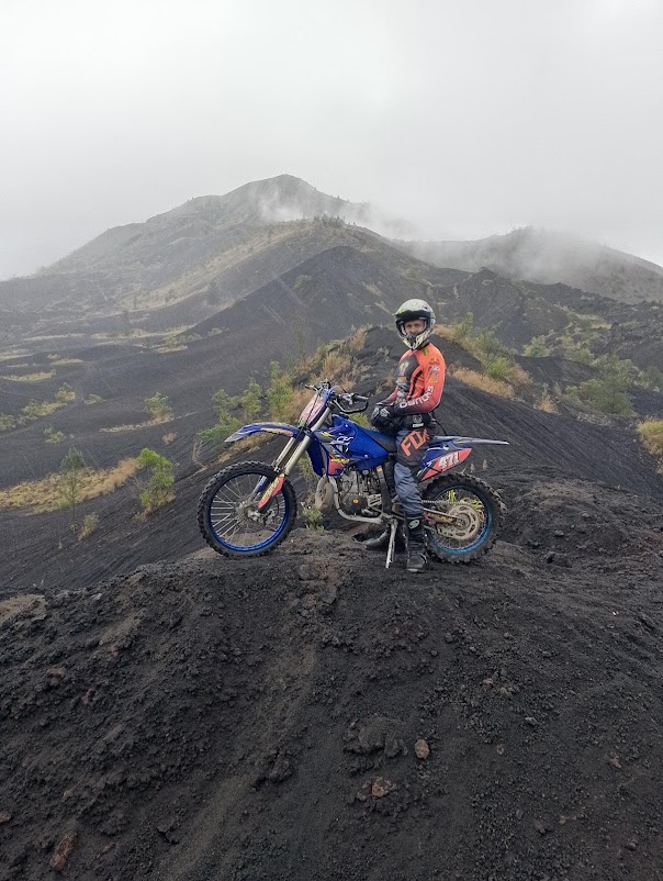
Batur volcano and lake
Vulcano And Lake's Batur
There is no need to doubt that Batur has a stunning view, like the strokes of God's hand arranged in such a way.
According to estimates from several scientists, this mountain is the highest mountain when viewed from its geographical location and the physical condition of this mountain. Mount Batur is currently only the peak of a mountain which falls into the belly of the mountain itself.
When we enter this area only the belly and peak are visible. If you look further you will find an estimate of how big this mountain was before it erupted. It is possible that this mountain was more than 3100 higher than Mount Agung before it erupted.
The remaining waste from this eruption is what makes this mountain so charming among the views of the mountains and lakes that patiently accompany the mighty Mount Batur. There are no words that can describe the beauty of the strokes of this divine hand.
History:
Mount Batur is an active cone volcano in Kintamani District, Bangli Regency, Bali, Indonesia.The southeast side of the caldera, which measures 10×13 km, mostly contains the caldera lake.
Both the larger caldera, and the smaller 7.5 km caldera were formed by the collapse of the mountain's magma chamber, the first larger collapse occurring around 29,300 years ago, and the inner caldera collapsing a second time around 20,150 years ago.
Explore the beauty of Mount Batur by taking part in the tour program here
Other estimates of the formation date of the inner caldera, formed during the eruption of the Bali ignimbrite, are between 23,670 and 28,500 years ago.
The first documented eruption was in 1804 and the most recent was in 2000.Caldera
Lake Batur
Located northwest of Mount Agung, the mountain has a caldera measuring 13.8 x 10 km and is one of the largest in the world (van Bemmelen, 1949). The height of the caldera embankment ranges from 1267 m - 2152 m (peak of Mount Abang).
Within Caldera I, Caldera II is formed, which is circular in shape with a diameter of approximately 7 km. The base of Caldera II is located between 120 – 300 m lower than Undak Kintamani (base of Caldera I).
Inside the caldera there is a crescent-shaped lake that occupies the southeastern part which is about 7.5 km long, 2.5 km wide, about 22 km in circumference and about 16 km2 in area, called Lake Batur. The Mount Batur Caldera is thought to have been formed as a result of two large eruptions, 29,300 and 20,150 years ago.
Explore the beauty of Mount Batur by taking part in the tour program here
Mount Batur consists of three volcanic cones with their respective craters, Batur I, Batur II, and Batur III.
Eruption
Lava from the eruption of Mount Batur (1926?) almost filled the temple for a moment in the temple complex.
Mount Batur has erupted many times. Mount Batur's eruptive activities recorded in history began in 1804 and the last eruption occurred in 2000. From 1804 to 2005, Mount Batur has erupted 26 times and the most powerful occurred on August 2 until the end of the 21st. September 1926.
Explore the beauty of Mount Batur by taking part in the tour program here
Tourist attraction
The Mount Batur area is famous as a mainstay tourist attraction in Bangli Regency. It is said that according to the story in Lontar Susana Bali, Mount Batur was the peak of Mount Mahameru which was moved by Batara Pasupati to become Sthana Betari Danuh (the palace of the Goddess Danu). At certain times, all Hindus from various regions in Bali come to Batur to offer Suwinih to ward off pests that befall their fields. By delivering this suwinih, the Mount Batur area becomes a fertile area.
Areas that can be highlighted as tourist attractions are craters, calderas and lakes. There is a water flow in the ground that flows the water of Lake Batur, which appears as a spring in several places in Bali and is considered the "Holy Water"
Explore the beauty of Mount Batur by taking part in the tour program here
The cultural tourism found in the Mount Batur area is Trunyan. Even though the entire population of Trunyan is Hindu like most Balinese people, they claim that Trunyan Hinduism is the original Hindu heritage of the Majapahit Kingdom. To the north of Trunyan is the kuban, a village cemetery, but the bodies are not buried or burned, but are placed under a tree after an elaborate death ceremony. This burial place is filled with bones, and it is possible that we will find a fresh corpse.The two natural tourist parks (TWA) in this area are TWA Gunung Batur Bukit Payang and TWA Panelokan.


.png)


Comments
Post a Comment